Buffalo Reef task force seeks Grand Traverse flooding information

Photo provided by Michigan Department of Environment, Great Lakes and Energy An excavator is used to remove stamp sands from the beach directly north of the breakwater at the Grand Traverse Harbor.
SCHOOLCRAFT TOWNSHIP — The Buffalo Reef Task Force wants reports from shoreline property owners about any flooding and ice shove events along Grand Traverse Bay.
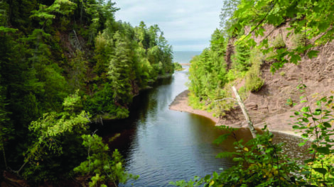
More than 20 million tons of stamp sands were deposited on the lakeshore in Gay from the Wolverine and Mohawk mines a century ago. Wind and currents have pushed them about 5 miles downshore, threatening fish spawning grounds and harbor access.
In 2017, storms on Lake Superior with record wave heights dumped stamp sands on the beach, undoing weeks of recent dredging work. The same storm led to flooding at numerous properties along Grand Traverse Harbor, said Steve Casey, a contractor with the Buffalo Reef Task Force, which is working on a permanent solution to the stamp sands issue.
Higher lake levels have made flooding a more pressing problem.
“As we develop a strategy of managing the stamp sands at Buffalo Reef, we want to make sure we’re not making that situation any worse,” Casey said.
Property owners located between the community of Gay and Grand Traverse Point, including those situated south of the harbor, are asked to fill out a brief reporting form at https://tinyurl.com/rsev7zh. They can describe the event and when it happened, as well as include a photo.
Knowing when and where flooding and ice shove have happened can help the design team make changes to reduce the problem, Casey said.
One option is to change the profile of the lake bottom immediately offshore, Casey said. The erosion of stamp sands has extended the beach 300 to 400 feet farther into the lake than the natural shoreline. The stamp sand grains are large and angular, causing the lake depth to drop off sharply, versus the more gradual incline of the natural lake bottom.
That means waves coming off Lake Superior face no energy loss before they arrive on the beach, allowing them to flood camps on the lakeshore.
“If we restore that profile, where there’s shallow water in front of the camps, the waves will break out in the lake before the beach and they won’t carry forward to homes,” Casey said.
The Department of Natural Resources made the form available Friday. Some data had already come in several weeks ago from a resident north of the harbor knowledgeable in geomorphology, Casey said.
Numerous dredging efforts have taken place over the past several years to protect Grand Traverse Harbor and Buffalo Reef, a premier spawning habitat and recruitment area for lake trout and whitefish.
From Nov. 14 through Dec. 6, 175,000 cubic yards of stamp sands were removed from the original milling site at Gay, according to a DNR release on the landowner questionnaire. This work included pulling a 25-foot-high bank of deposited sands back from the Lake Superior shoreline.
Throughout January, 13,255 cubic yards of stamp sands were taken from the Grand Traverse Harbor and another 32,677 cubic yards of material was moved from the adjacent beach.
“It’s very significant to see the State of Michigan has made a big commitment to protecting Buffalo Reef, and part of that commitment includes keeping the harbor open,” Casey said. “They spent a lot of money this winter, both on the harbor and putting back the sand at the original pile. That’s going to go a long way towards protecting the reef and keeping that harbor open.”
The trough north of the reef is slated to be dredged this spring – which, this being the Upper Peninsula, probably means May or June, said task force member Stephanie Swart, Lake Superior coordinator for the Michigan Department of Environment, Great Lakes and Energy.
That dredging will probably be about 20,000 cubic yards, Swart estimated, aimed at stopping a ridge of stamp sand from overtopping the north jetty at the harbor.
“I think the goal is to have a set amount of money put aside so we can deal with the overtopping of the breakwall,” she said.
Longterm, a team of engineers and scientists from the U.S. Army Corps of Engineers is working with the task force for cost estimates and other details for three longterm solutions for the encroaching stamp sands. The task force narrowed the list down from 13 after a process including several public hearings and comment periods.
The three are: building a retaining wall to contain the stamp sands at the original pile, as well as the stamp sands dredged from the lake and beach; building a landfill in an upland area near the community of Gay for the stamp sands removed from the lake and beach; and placing the stamp sands removed from the lake and beach in the tailing basins at the former White Pine Mine in Ontonagon County.
When the cost estimates are finished, the task force will take that information to the public as part of selecting the ultimate course of action.
There is no firm timeline for when the cost estimates will be finished, Casey said.
“There’s a lot of moving pieces here in terms of getting additional data,” he said. “The survey on ice shove and flooding is one of those.”