
Snow, winds force closures in Keweenaw
Trending
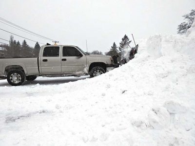
HOUGHTON -- The first storm of the year hit the Keweenaw Tuesday night and Wednesday morning, resulting in high winds and several inches of snow.
A low-pressuring system rolling from the central Plains caused most of the snow up through Wednesday morning. As it hit the Great Lakes, it interacted with additional moisture from Lake Superior, said Joe Phillips, a meteorologist with the National Weather Service in Negaunee. That led to a transition from the wet snow of early Wednesday morning to the larger lake-effect flakes of Wednesday afternoon.
"At this point, where Lake Superior's not ice covered, it's still an energy source, and that's providing an extra kick to the snow development," he said.
While storms such as the severe wind event of mid-December are only seen only every few years, this week's is a more typical seasonal event, Phillips said.
How much snow did it bring? As of Wednesday afternoon, few observations had come in to the NWS office, Phillips said. The NWS office in Negaunee had recorded 6 inches as of 1 p.m. Multiple readings in the Marquette area showed about 7 inches. As for the Keweenaw, which often has higher totals, those numbers could remain unknown until Wednesday night or Thursday morning, Phillips said.
Reports of snow drifts had come into the NWS office from across the western Upper Peninsula, down to Iron Mountain. At the Houghton County Memorial Airport, gusts were about 35 mph. They were about 10 miles higher closer to Copper Harbor.
"With the blowing winds and the snowflakes transitioning to a drier snow, these are going to be easier to carry with the wind," Phillips said.
Local schools closed Wednesday, as did the Portage Lake District Library.
There were several road accidents, peaking during the morning commute, though nothing out of the ordinary, the Houghton County Sheriff's Office reported.
Phillips encouraged motorists to drive cautiously, leave plenty of braking distance and turn their headlights on even during daytime.
The system is now centered in Lake Huron, while some of its upper-level support is trailing behind over Lake Michigan. Winds will be mainly out of the northeast until early Friday, before shifting to westerly or southwesterly.
"It's plausible that you could have lake effect continuing until about that point," he said.