Buffalo Reef plan announced
Task force plans 240-acre landfill upland from harbor for stamp sands
LAKE LINDEN — The preferred plan for saving Buffalo Reef from encroaching stamp sands was unveiled at a task force public meeting in Lake Linden Tuesday night.
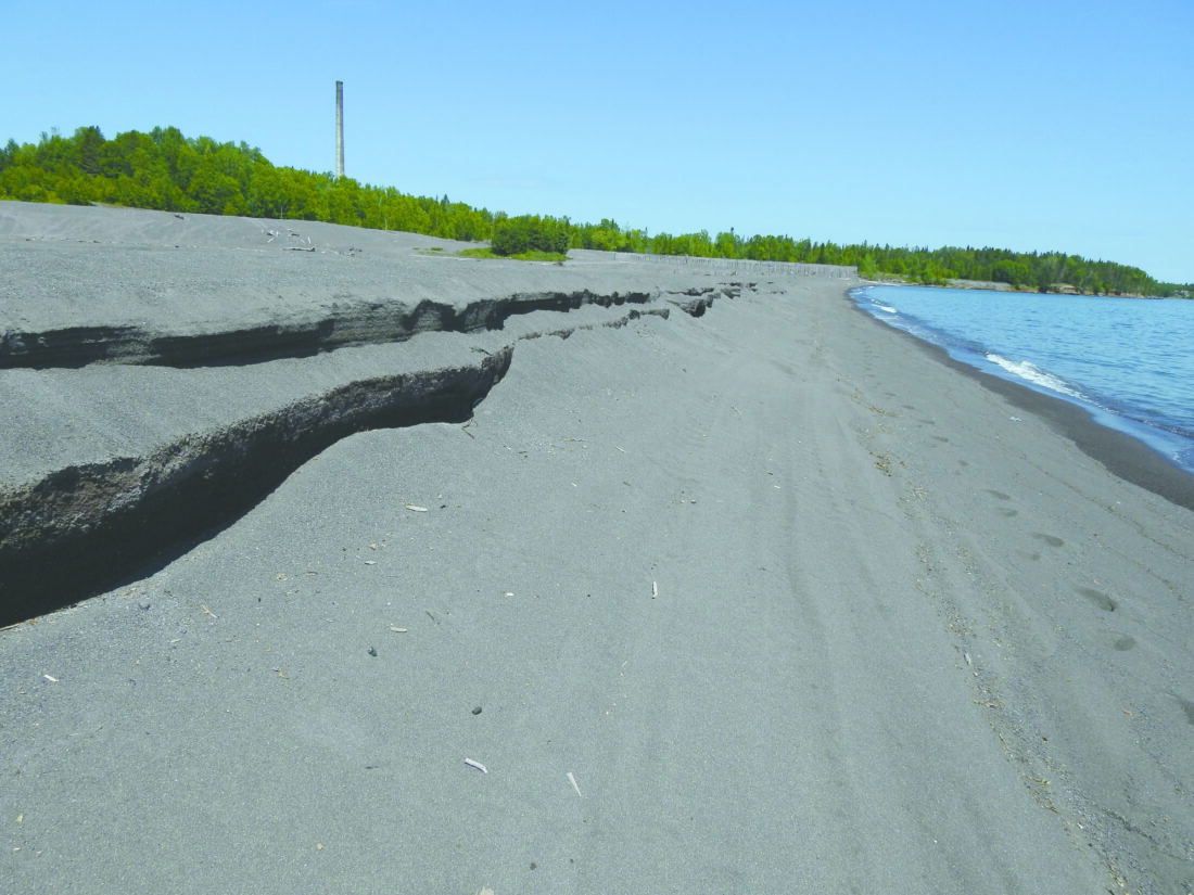
Since 2019, the multiagency task force has been studying possibilities for dealing with the copper tailings piled along the lakeshore in Gay, which a century of winds and currents have swept five miles north to Grand Traverse Harbor in Schoolcraft Township. They’ve affected the harbor, adjacent beaches, and the 2,200-acre Buffalo Reef, a prime spawning ground for lake trout and whitefish in Keweenaw Bay.
Under the plan revealed Tuesday, the 2.2 million cubic yards of stamp sands still on the shore in Gay — about 10% of the original volume — would be moved to a 240-acre landfill to be built upland of the harbor. Stamp sands dredged from the harbor and cleaned from the beaches would also be added to the landfill.
It won’t be simple or fast, task force members said Tuesday. The price is expected to be upwards of $1 billion for the project, which if funding can be secured would start around 2025 and continue through 2044.
“Nobody’s going to hand you a giant check and say, ‘Here you go, Steve, go execute,” said Steve Check, project manager with the U.S. Army Corps of Engineers. “Typically what happens with any governmental budget, it’s incremental funding.”
The project still needs to secure a non-federal sponsor, such as the state of Michigan. The sponsor would own the landfill property and own, operate and maintain facilities and infrastructure.
The first priority of the project would be building a coal dock jetty, which would extend about 2,000 feet into the lake to help block stamp sands from reaching the reef and harbor. It would also provide a place to put equipment for maintenance dredging of the harbor, said Jay Parent, water resource district manager for the Department of Environment, Great Lakes and Energy.
Drainage from the lined placement area will be piped downhill, where it will be mixed with fresh water and released through a high-velocity diffuser and diluted into the lake at a copper level that is non-toxic, Parent said.
“Every time there’s a big storm, you go out here, this whole bay is red,” he said. “That’s copper… if we can get it up here, stable, and sitting here, and not being turned up all the time, the copper level coming off that pile will be much lower.”
Once the infrastructure for storage and treatment is built up, removal will begin, starting with dredging at the Grand Traverse Harbor, which is slated to take place from 2025 to 2032.
After the harbor is done, cleanup will include the shorelines, an underwater dune area and a trough spilling onto the reef, ending in 2043. The original stamp sand pile in Gay will be removed between 2038 to 2040.
The plan also calls for bringing in clean sand to restore beaches to their pre-1938 state, Parent said.
Excavation will be done mechanically, rather than hydraulically. That method, often used to dredge muddy waters, led to frequent mechanical failure when applied to stamp sand.
Two other alternatives made it to the final stage of consideration. The first, moving the tailings to the White Pine mine in Ontonagon County, was eliminated quickly. The cost of moving them by ship and unloading it was “astronomical,” Check said. A second plan of building a revetment at the beach in Gay was dropped because of permitting issues and the ongoing maintenance that would be required.
“If you’re going to build a revetment on the water and not expect to have to do any type of maintenance to that structure, it’s just not feasible,” Check said.
With no intervention, the stamp sands could imperil the Keweenaw Bay’s lake trout and whitefish, which use Buffalo Reef for a spawning ground. Task force member Steve Casey showed the results of a 2005 USGS study finding that lake trout and whitefish congregated in about 10% of the 2,200-acre reef. The USGS also studied the effect of stamp sands on incubation. With no stamp sand, about 70% of the eggs hatched; in 100% stamp sand, only 10% hatched.
“Obviously the stamp sand is affecting the hatching success, probably because of the copper in the water,” Casey said.
The hatchlings from stamp sands also showed greatly reduced energy, Casey said.
A model showing the path of the stamp sands if left unchecked showed the sands filling the harbor and advancing further down the lake and shore. The juvenile whitefish habitat would be about 80% stamp sands, Casey said.
The harbor plugging up could also cause the Traverse River to reroute to find a new channel, Casey said.
The budget passed by the state legislature earlier this month includes $10 million for the project, which would mainly go towards construction of the coal dock jetty.
State Rep. Greg Markkanen urged residents to contact the governor’s office to advocate for keeping the funding in the budget.
“Call her constituent hotline and let them know how big a concern it is for our area,” he said.
Most residents who spoke at the meeting were supportive of the plan. Some residents criticized the plan for restricting beach access or for disrupting property; one person brought a trash bag full of material on his property from the previous attempt at hydraulic excavating.
Marie and Bob Nichols, who live on Big Traverse Bay, backed the proposal.
“I hope the plan goes through, because it’s going to be great,” Marie said after the meeting. Quoting another audience member who spoke earlier, she added, “We need to do something.”
The task force’s official report will be released in August, and will be made available on the DNR’s Buffalo Reef website at michigan.gov/dnr/managing-resources/fisheries/units/buffalo-reef. It will be open for public review and comments for a 30-day period.
The final report is expected in mid- to late October.