Plenty to go around
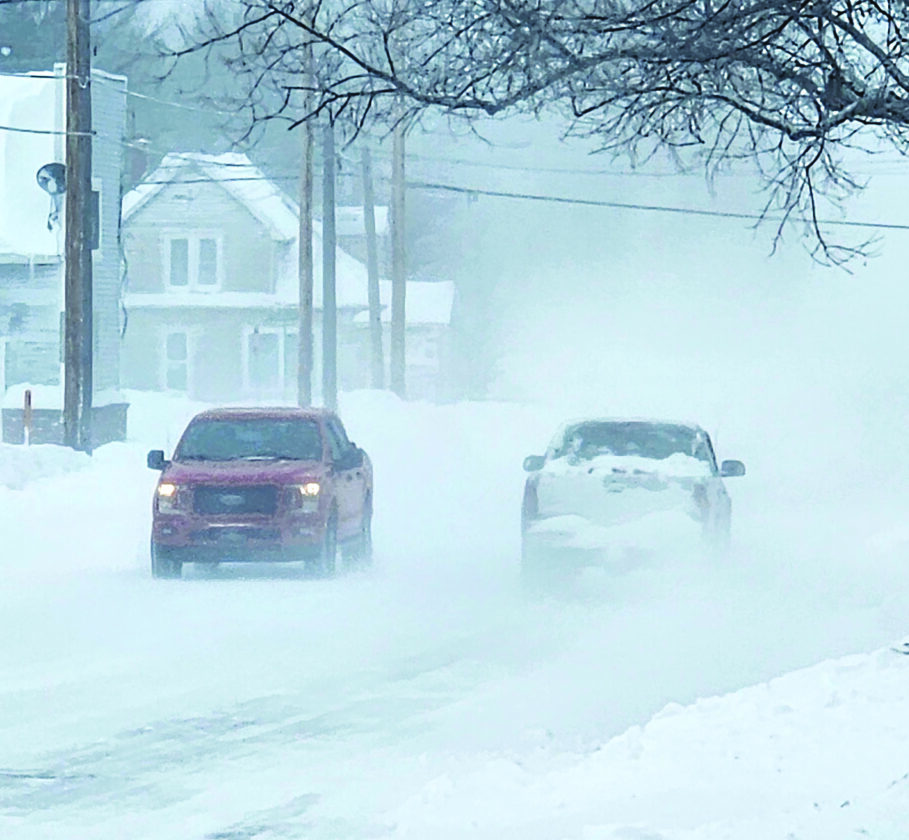
Blizzard reached beyond "Snow Belt"
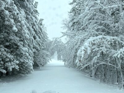
Paula Porter for the Gazette A blizzard that produced more than a foot of snow and winds in excess of 60 mph hit the entire Upper Peninsula Sunday. This photo taken Monday in Calumet is typical of what most drivers in the UP experienced.
MARQUETTE — The blizzard that struck the Upper Peninsula beginning Sunday evening, with heavy snow and high winds, was not limited to the traditional UP “snow belts” but impacted most of the central and western peninsula as well.
According to information from Meteorologist Joseph Phillips from the National Weather Service office in Marquette, around a foot or more snow fell in at least 10 of the UP’s 15 counties. Even in the traditional “banana belt,” they were digging out Monday morning. On average, Houghton, Keweenaw, Gogebic, Baraga and other western counties receive more snow in a month than Delta, Dickinson and Menominee counties see during the entire winter. However, this time no one was spared. The National Weather Service said that Gladstone and Escanaba, two communities on Lake Michigan’s Little Bay de Noc, that rarely report heavy accumulations, recorded 14.2 and 13.0 inches repectively from Sunday evening through Monday morning. Daggett in Menominee County came just under the one foot mark with 11.5 inches of snow while Manistique on Lake Michigan received 9.7 inches.
As to be expected, the south shore of Lake Superior received more that its fair share of snow. Led by Clarksburg, at an even two feet, most of Marquette county saw in excess of 12 inches, including Negaunee (22.3″) Big Bay (18.7″), Little Lake (18″) and Ishpeming (15.5″). Alger County with 17.5 inches reported at Munising, Gogebic County, 18″ in Ironwood and Ontonagon County’s Paulding with 12.9 inches all received their fair share.
But as is the norm the Keweenaw wasn’t spared this time around, as Houghton, Baraga and Keweenaw counties all reported locations receiving between 12 – 20 inches of snow.
But according to the National Weather Service, large amounts of snowfall is not the lone criteria for a blizzard. In order to qualify as blizzard conditions, the snow must be accompanied by high winds and poor visibility. The UP checked both those boxes Sunday night. Nine central and western UP counties reported wind gusts in excess of 50 mph, according to NWS reporting. In additiopn, Schoolcraft, Alger, Houghton and Keweenaw counties all reported winds surpassing 60 mph — the speed of the Lake Superior winds the night the Edmund Fitzgerald sank in 1975.
It was on the water where the highest wind gusts were found Sunday. Stannard Rock Lighthouse in Lake Superior reported 69 mph gusts while Minneapolis Shoal Light south of Escanaba on Lake Michigan’s Green Bay reported the windiest conditions in the UP at 70 mph.
Despite the heavy snow and high winds there were not major accidents reported due to the weather and the wide-spread and often lengthy power outages that accompanied the Thanksgiving Weekend storm, really never materialized to any great degree. The National Weather Service predicts things will calm down a tad for the first weekend of 2026 with a 30 percent chance of show New Years Day and little to no precipitation for Friday and Saturday.
Front Page
No paper Thursday
With no mail delivery on New Year’s Day, the Daily Mining Gazette will not publish newspaper Thursday. There ...
Goose-gassing and spearfishing

Plenty to go around

Remembering Mike Lahti

Unemployment benefits go up Thursday