It’s probably not over
Winter on track to deliver 'St. Patrick’s Day storm'
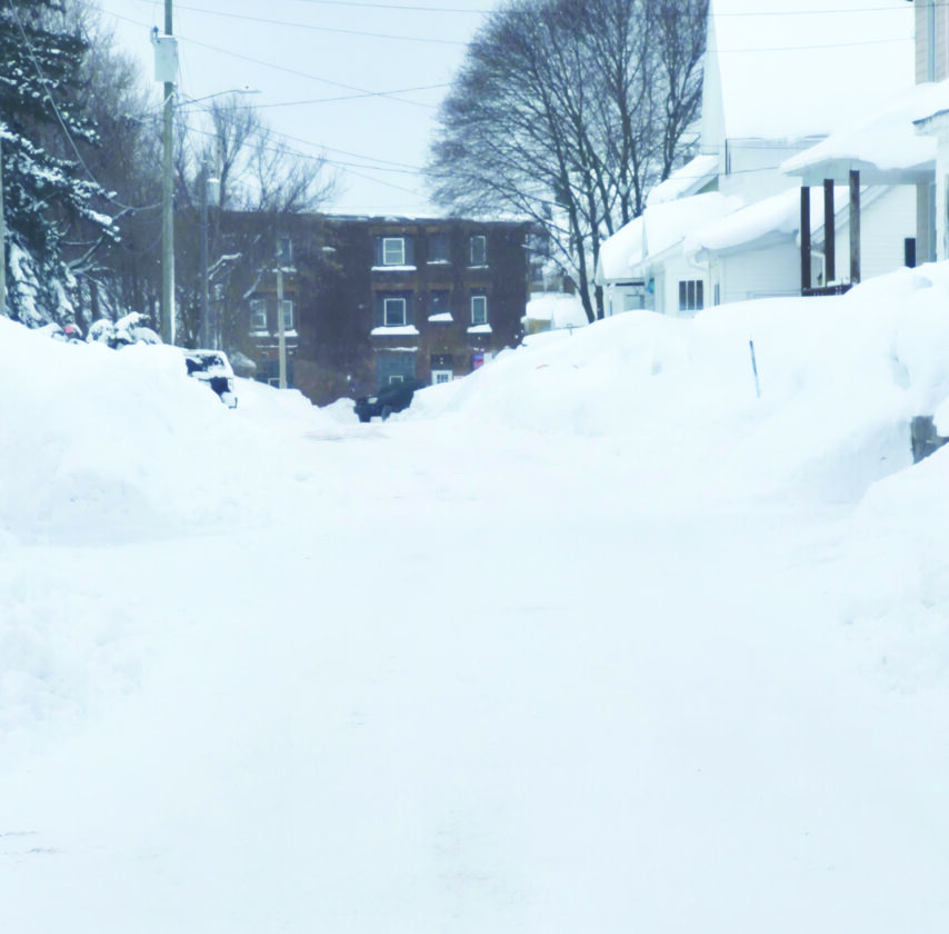
Graham Jaehnig/Daily Mining Gazette After a spring tease, winter will remain on the Keweenaw Peninsula into April, according to predictions.
HOUGHTON – The season snowfall total as of Tuesday morning has reached 299.25 inches, according to the Keweenaw County Road Commission. Much more is on the way, according to the National Weather Service Marquette Office (NWS) in Negaunee Township.
Meteorologist Nick Langlieb said there is a strong chance the Keweenaw will break last year’s total of 315 inches.
“It’s a pretty safe bet that that record’s going to get broken,” he said.
After a spring tease, Langlieb said Sunday marks the beginning of an active weather pattern. Multiple storms systems will move through the region, he said, that will impact the U.P., and more snow this week.
“We’ve got widespread snow for Tuesday into Wednesday,” Langlieb said. “Right now, it looks like the heaviest snow will be south of the Keweenaw Peninsula. We’re looking at around six inches around the Keweenaw Tuesday night into Wednesday.”
Thursday night into Friday, another system will move through, but currently, it may miss the Keweenaw Peninsula.
Currently, Langlieb said, it appears most of the snow will impact the eastern and southern U.P, but the Keweenaw could still see three to six inches of snow. That prediction could change, however, with just small shifts in the weather track.
“It’s a pretty vigorous clipper system that’s going to come through,” he said. “It’s a fast-moving system, but it’s going to put down some heavy snow.”
Langlieb said another system may move through Saturday into Sunday.
“Some of the guidance keeps it clear of the U.P.,” he said. “Other guidance would have a pretty significant storm moving through the U.P. We’re watching it. It’s definitely something for people to pay attention to.”
Langlieb said the six to 10-day outlook calls for below normal temperatures and above normal precipitation, adding: “That continues into the eight to 14-day prediction as well.”
Temperatures will also change toward the beginning of next week.
“Monday will probably see highs in the teens and breezy weather,” he said, “so, it’s going to feel like winter, for sure.”
Langlieb said the U.P. made some headway on snowmelt last week, but much of it is going to come back.
“We get into the transition season and then we start getting that higher moisture back up here, and we see some of these bigger storms start coming through the U.P.,” said Langlieb. “We’re back into that time of year.”