
Fighting the wildfires
DNR consolidates efforts
Trending
HOUGHTON -- Rough terrain, falling trees, slippery rocks, and impassable roads continue to confront crews across the Upper Peninsula as the Michigan Department of Natural Resources (DNR) officially consolidated the management of three wildfires under a single Incident Management Team, designating the unified operation as the Rugged Terrain Complex.
The DNR emphasized Saturday that managing the Ridge, Craig Lake and Black River fires as a unified complex allows for better tactical coordination, expanded logistical support, and more streamlined communication for the 97 firefighters currently assigned to the lines.
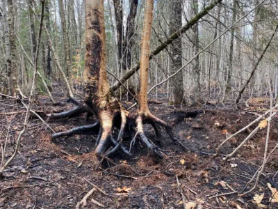
According to updated complex statements released Saturday morning, a substantial amount of rain received across the region has successfully minimized active surface fire behavior, with no further environmental fire spread anticipated. However, due to the significant physical hazards posed by deeply burned, weakened root systems and sustained high winds across all three zones, ground crews spent Friday focusing heavily on equipment rehabilitation and perimeter patrols rather than active line cutting.
Containment parameters have shifted significantly across the three primary zones:
• The Craig Lake Fire: Located north of Craig Lake State Park in Baraga County, the complex's largest active blaze is holding at 606 acres and is now 70 percent contained. First detected by a DNR patrol pilot on October 8, investigators confirmed the fire was sparked by a lightning strike from early October storms. To ensure public safety during ongoing suppression operations, the DNR has temporarily closed the park north of Craig Lake proper, the Teddy Lake Yurt, and the local segment of the North Country Trail through the end of October. The remainder of the park remains open.
• The Black River Fire: Situated approximately four miles south of Wakefield in Gogebic County, this western U.P. blaze is holding at 350 acres and has reached 70 percent containment. Initially detected on October 11, the fire was first managed by the U.S. Forest Service before the DNR assumed direct operational command on October 13. While there are currently no road or trail closures associated with the Wakefield site, fire officials are urging partridge hunters, woodcutters, and local motorists to avoid the immediate area east of County Road 519 for their own safety and to prevent interference with active bulldozer operations. Its cause remains under investigation.
• The Ridge Fire: Positioned roughly 10 miles northwest of Marquette near the Dead River Basin and west of County Road 510, the 466-acre blaze has advanced to 40 percent containment. Spitted by an air patrol pilot on October 9, its cause remains under investigation. Under the regional “Ready, Set, Go!” safety protocol, the evacuation status for residents along North Basin Drive remains at a “Ready” alert, advising citizens to remain prepared for potential environmental shifts. The neighboring Noquemanon Trail system west of the County Road 510 trailhead remains closed.
A five-nautical-mile temporary flight restriction remains strictly enforced below 3,500 feet over both the Ridge and Craig Lake fire zones to protect active state and federal aviation coordination. Planners reiterated that unauthorized personal drone flights are legally prohibited in the airspace, warning that any drone activity will result in an immediate grounding of all defensive firefighting aircraft.
Cooperating on the Rugged Terrain Complex suppression efforts are the U.S. Forest Service, the Marquette National Weather Service, the Michigan State Police, the Marquette County Sheriff's Office and Emergency Management, Baraga County Emergency Management, the Gogebic County Sheriff's Office and Emergency Management, the Keweenaw Bay Indian Community, the Bay Mills Indian Community, Negaunee Township, the Michigamme-Spurr Fire Department, the Bessemer Township Fire Department, the Wakefield Volunteer Fire Department, Lyme Timber Great Lakes, and the DNR Law Enforcement Division.