
It’s baaack
First snow hits region
Trending
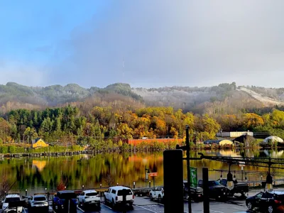
HOUGHTON -- The Upper Peninsula experienced its first measurable snow of the 2026-2027 winter season Friday and according to meteorologist Ben Warren of the National Weather Service Marquette office, it fell evenly across the region and was not a significant amount.
"It was mostly just traces here and there, flurries across much of the area," Warren said. "But the central Upper Peninsula, kind in the higher terrain, Marquette and Baraga counties, that really won out. We got a couple of inches in some spots up here at our office. I think we’ve had almost three inches so far. I think it was just shy of that, but yeah, elsewhere, not too much."
Warren said noted uneven distribution is common during early seasonal transitions. "I mean, with the first snow of the season, that’s pretty typical. It kind of sticks to elevated surfaces and on the grass eventually. With the ground being so warm at this time of year still, it takes a little bit of snow for it to actually finally stick. You’ll see it a lot on cars first before the ground actually starts accumulating."
Even in the Keweenaw Peninsula, specific localized zones received measurable snow while areas along the range recorded zero accumulation.
"Well, that’s also kind of the nature of lake-effect snow in general, of course," Warren said. "Sometimes it can just be real scattered or you can get a banded structure. The snow bands can really pinpoint snow in one area. It’ll come down real hard for a second, clear up for another second and then come down again with the scattered nature of just how these snow showers work."
Warren explained that the transition from standard rain to winter accumulation is dictated by atmospheric temperature differentials across the upper Great Lakes.
"Basically, we’ve had this really slow system kind of moving up towards the upper Great Lakes the last couple of days and it’s given us some pretty good rainfall across the area," Warren said. "But then finally, once that got kicked out a little bit more to the east of the Upper Peninsula, we had a good shot of cold air come down out of Canada and at this time of year, we call it the unstable season."
According to NWS data models, lake-effect precipitation occurs when the temperature differential between the warm lake surface and the air roughly one and a half kilometers off the ground creates unstable atmospheric columns, Warren said..
"Widespread stratiform rain transitioned to more of this lake-effect precipitation regime," Warren said. "Finally the cold air worked its way down to the surface, getting enough of it to transition from lake-effect rain to pure lake-effect snow. The other thing too at this time of year is that right along the lake shore, the lake keeps it pretty warm still."
Long-range forecast models do not predict significant winter accumulation in the immediate future.
"We do warm up again through this week," Warren said. "We might get a couple shots at some light snow accumulations here and there, just with some weak systems rolling through and maybe a little bit of some lake effect through the midweek and late week. But no big snowmakers on the horizon, kind of still back into that warmer and drier than normal period for the most part."