Calumet Area Trails Group finalizes concept plan, announces presentation

Photo courtesy of Main Street Calumet Clockwise from upper left; KNHP Landscape Architect Steve DeLong answers questions from members of the public during a community outreach session in October, 2019.
CALUMET — The Calumet Area Trails (CAT) Group finalized its concept plan for the trail system, and has announced a scheduled presentation for later this month.
The group’s vision has to form a system of trails, routes and pathways that connect parks, other trails and trail networks and Calumet area communities.
“The CAT will enhance the quality of life and sense of place for residents and visitors,” states the group’s website, “by providing a way to explore the area’s cultural, natural, and recreational resources. The trail system will foster health and safety, strengthen community ties and local businesses, and support restoration and conservation efforts in this beautiful, nationally significant landscape.”
The group started in 2018, when Main Street Calumet (MSC) began working with support of local governments, KEDA, the Keweenaw Convention & Visitor’s Bureau (KCVB) and the Keweenaw National Historical Park, and received a technical assistance grant from the National Park Service’s Rivers, Trails and Conservation Assistance (RTCA) Program to coordinate a planning effort to plan and develop the trail system concept, seek community feedback on the proposal and assist in preparing a report, said Leah Polzien, executive director of Main Street Calumet.
“That opportunity led to the creation of the CAT Group, a community collaborative focused on improving the motorized and non-motorized trail network in and around Calumet,” said Polzien.

Photo courtesy of Main Street Calumet An overview map of the focus area for Calumet Area Trails including some suggested improvements.
Polzien said the finalized concept plan identifies gaps such as missing linkages; along with needs such as a wayfinding system; and connection opportunities to existing trail systems in Houghton and Keweenaw counties.
Representatives of the organizations and municipalities have applied to the National Park Service, Rivers, Trails and Conservation Assistance program for technical assistance in planning a cohesive trail system around and through Calumet Township and the villages of Calumet and Laurium, said Polzien. A broad-based partnership has been formed to direct the project, which includes:
– Main Street Calumet, Inc
– Village of Calumet
– Village of Laurium
– Calumet Township
– Keweenaw Snowmobile Club
– National Park Service Recreation, Trails and Conservation Assistance Program
– Keweenaw National Historical Park
– Keweenaw Convention and Visitors Bureau
– Keweenaw Economic Development Alliance
– Western Upper Peninsula Planning and Development Region
– Michigan Technological University Geospatial Research Facility
– Swedetown Trails Club
– Keweenaw ATV Club Local Businesses
The partners have been meeting since March 2019 to develop a foundation for planning. The team has created a map of the area’s motorized and non-motorized trails, and has begun to identify general issues and locations to improve access and enhance connectivity. Open spaces, outdoor recreation sites, and key landmark historic sites will be included on the map.
The CAT group’s Concept Plan public presentation will take place on Wednesday, April 28, at 5:30 p.m. The meeting will be conducted online via The presentation will be given Go To Meeting at the following link
https://global.gotomeeting.com/join/883984733 or join by phone by calling +1-312-757-3121 and entering access code: 883-984-733. The Concept Plan is available for viewing at https://www.mainstreetcalumet.com/calumet-area-trails-planning.html.
Printed copies of the Calumet Area Trail Committee Concept Plan is available for viewing on-line. Limited print copies will be provided to local governments and stakeholder groups.
-
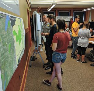
- Photo courtesy of Main Street Calumet Clockwise from upper left; KNHP Landscape Architect Steve DeLong answers questions from members of the public during a community outreach session in October, 2019.
-
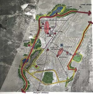
- Photo courtesy of Main Street Calumet An overview map of the focus area for Calumet Area Trails including some suggested improvements.
Front Page
Calumet celebrates Camborne connection
Number of diplomats to visit Juhannus increases
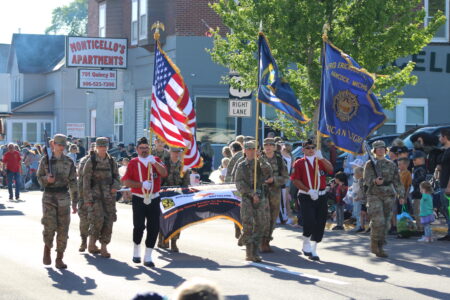
Bridgefest Parade fun
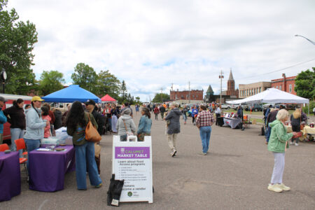
Calumet Farmers Market opens for season

Best in show
Finno-what? Hancock: The first Finno-Ugric capital across the ocean
There’s been much talk about “Finno-Ugric” this past year in the Copper Country. The first part might ring a ...