A snowy holiday
More than a foot possible
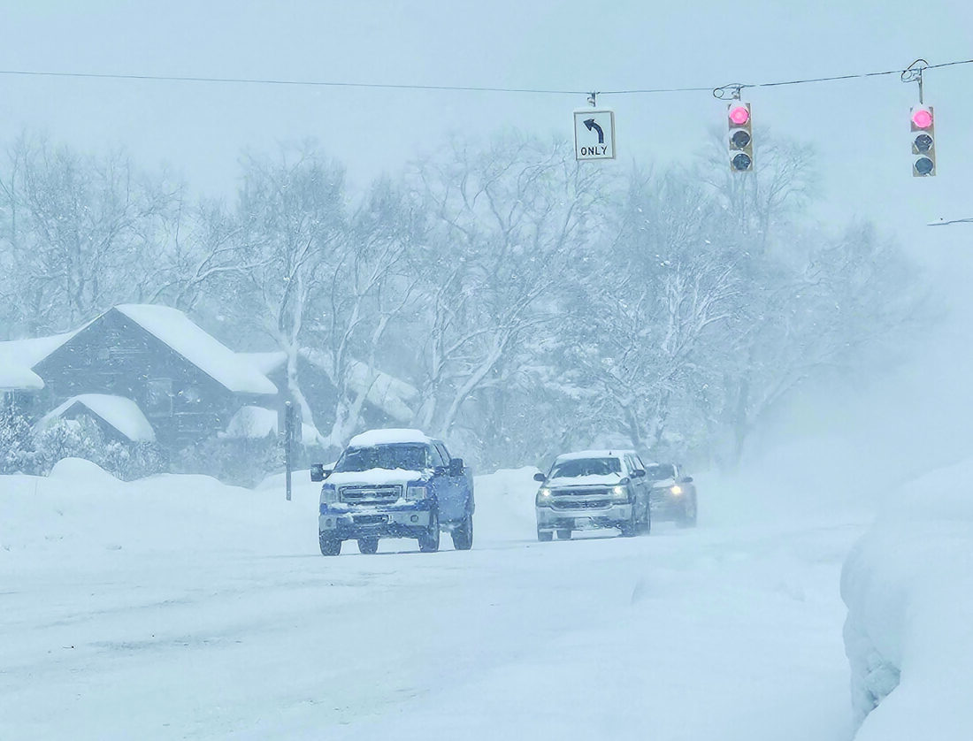
Paula Porter, for the Gazette The National Weather Service has issued a winter snow warning, with totals in excess of a foot of snow possible. This photo taken last December reminds us of what we could expect.
MARQUETTE — The National Weather Serivce is predicting the first major snow storm could hit the western Upper Peninsula during the Thanksgiving Holiday weekend. The NWS office in Marquette has issued a winter storm warning for Northern Houghton, Ontonagon, Keweenaw and Gogebic Counties, including the communities of Houghton, Hancock, Calumet, Ironwood, Ontonagon and Copper Harbor. As of Tuesday morning, the winter storm warning began Tuesday evening and was expected to remain in effect until 7 p.m. (EST) tonight.
Heavy snow is expected during this period with total snow accumulations of between 14 – 25 inches possible. In addition to the heavy snow totals, winds gusting as high as 50 miles per hour could lead to blizzard conditions.
According to the National Weather Service, “travel could be very difficult to near impossible. Widespread blowing snow could significantly reduce visibility to a quarter mile or less for several hours.” The hazardous conditions were expected to impact travel beginning Tuesday evening and continue into today’s morning commute. The gusty winds could bring down tree branches which has the potential to cause power outages.
The NWS advises those who must travel to keep an extra flashlight, food, and water in your vehicle in case of an emergency.Michigan State Police Community Service Trooper Alan Narhi said in an interview with the Mining Gazette earlier this month that driving safely in the winter begins before a vehicle pulls onto the street. He said drivers should warm up their vehicles before driving and remove all ice and snow from not only the windshield and side mirrors, but also the top of the vehicle. Built up ice and snow on the top, bumper or trunk of a vehicle can get caught in the wind and fall onto other vehicles or it can slide down and cover the windshield, obstructing the driver’s view of the road.
“And now that person is is in danger of losing control of their vehicles, and they have a big pile of snow flying out,” Narhi said. “Cleaning the windshield and cleaning off your car fully is something that we want to remind people to do, because we see that accident often.”
Another preparation drivers should make before pulling out of the driveway is to have an emergency kit in their vehicle. “Blankets, coats, winter hats, gloves, bottles of water and snacks such as granola bars should be handy in the event an accident occurs and the driver and passengers are waiting for emergency services,” Narhi said. He adds that cat litter could also be packed to use as traction on icy surfaces if a vehicle is not moving easily but not entirely stuck. Narhi also recommends utilizing an MDOT online tool called Mi Drive. Mi Drive will reveal road conditions and inform drivers of what state roads (M) and US roads have been plowed.
Once the winter storm warning expires tonight, the NWS advises there is a Hazardous Wether Outlook in effect through Monday. Lake effect snow and wind could impact the Thanksgiving holiday weekend. Heavy and blowing snow has the potential to make travel very difficult to nearly impossible at times.
Travelers and interested parties should continue to monitor the forecast and make appropriate changes to plans in response to hazardous winter conditions. In addition to the snow and blizzard conditions, the weather service says minor lakeshore flooding and beach erosion is possible across the Lake Superior shoreline today through Thanksgiving.
The latest weather advisories and current conditions are available at weather.gov