Historic documents may identify Greenland well
GREENLAND TOWNSHIP — An August 1 release from the Michigan Department of Natural Resources states that a water source supplying two residents, and an unregulated spigot, has been confirmed in the Ontonagon County township.
The release also states that a search of historic maps and documents, as well as interviewing locals familiar with the area, has been ongoing for several months.
Historic documentation researched by the Gazette offers a description identifying the location of the well.
The documentation is in the form of the Annual Report of the Lake Copper Company for 1911. The report features contributions from T.H. Bennett, who was superintendent of the mine, which states in part:
“In March 1910 as ordered, a 4″ pipe was driven 186 feet vertically through clay and quick-sand to a bed of gravel, where a considerable flow of water was encountered which reaches the surface under a head of about 28 ft., sufficient to enable us to pipe it about the location for domestic use.”
The DNR release relays EGLE officials’ determination that the water supply was “likely an artesian flow underground that was drilled into through native clay,” which confirms the Lake Copper Company’s description.
William A. Paine, who was president of the Lake Copper Company in 1911, included in the company’s annual report for that year, corroborated Bennet’s report, stating in part:
“Toward the end of last summer (1910) water pipes were laid in the location and were connected to a tank placed upon the old Belt Bluff, so that pressure could be obtained for both domestic purposes and fire protection. A kerosene-driven pump was provided to raise the water. The supply of water was insufficient and another sand pipe was put down to a depth of 135 feet, from which a moderate stream of very good water was obtained. Between this and the old hole by the boarding house, it is hoped that a sufficient water supply has been obtained.”
Paine’s letter is dated June 16, 1911.
Historical verification of well construction could help officials determine the viability and continued use of the water source according to the DNR release.
In Feb., a DNR spokesman said that the well was a very old, unregulated water system that has not been tested for all the required parameters, and appears to contain nearly a mile of water line beneath an old railroad grade with piping in a questionable condition.
However, in Feb. Markkanen and several other state officials confirmed a previous statement from Greenland Township that the township has been regularly ordering testing of the water from the source for decades, and that the water exceeds Michigan’s water quality standards.
The wellhead is a short distance off the Bill Nichols trail, roughly a half-mile from the spigot, which is situated not far east of M-38 at the former site of Lake Mine, a historic mining community.
The state acquired the trail in 1974 when the Copper Range Company donated the former Copper Range Railroad line to the DNR for use as a recreational trail.
Front Page

Suspects arraigned in animal abuse case

Venezuela earthquake death toll tops 1,400
Firemen’s tourney held in Laurium
LAURIUM — The 72nd annual Copper Country Volunteer Firefighter’s Tournament was held Saturday in Laurium with ...
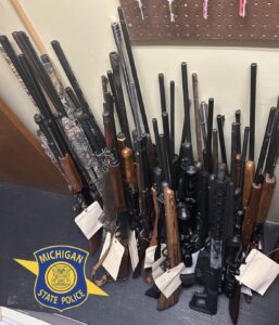
Garden man arrested on weapons and drug charges

Keweenaw Co. to join MRCC
