Winter storm ends Wednesday

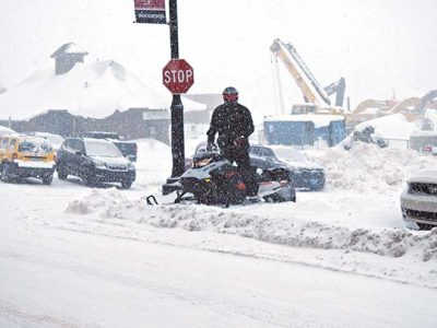
Garrett Neese/Daily Mining Gazette A snowmobiler parks during heavy snow Tuesday afternoon.
HOUGHTON — The winter storm that hit the Keweenaw Monday was on track to leave by early Wednesday, but not before dumping more than a foot of snow throughout the region.
The storm began when a flow of moisture moved over a frontal boundary to the south into colder air over the area, said Don Rolfson, a meteorologist with the National Weather Service in Negaunee.
“We haven’t seen that much this winter,” he said. “It’s led to this prolonged period of snow we’re currently seeing.”
As of this morning, there had been 10.5 inches of snow in Keweenaw County, according to the county road commission. In general, most of the Copper Country had logged between 4 and 8 inches as of Tuesday morning.
More heavy snowfall was on the way. A winter storm warning from the NWS issued late Tuesday morning anticipated another 5 to 10 inches before the warning’s end at 7 a.m. Wednesday. The heaviest snow was projected to fall from late Tuesday evening.

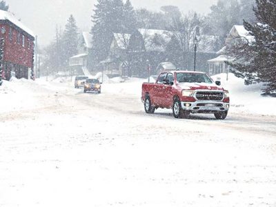
Garrett Neese/Daily Mining Gazette Vehicles drive down Shelden Avenue Tuesday afternoon.
Gusts of up to 25 to 35 mph were expected Tuesday night. On the shoreline in Keweenaw County, gusts could reach up to 40 mph, Rolfson said.
Blowing snow drastically reduced visibility affected night commutes, the NWS said. If people must travel during such conditions, the NWS said, they should keep an extra flashlight, food, and water in your vehicle in case of an emergency.
Being outside a vehicle wasn’t expected to be any better. With wind chills as low as 20 below zero, people can get frostbite on exposed skin in as little as 30 minutes, the NWS said.
There was expected to be a “decent clip” of snow overnight, Rolfson said, tapering off in the morning once drier air moved in.
The storm will not leave a tropical paradise in its wake. But aside from light lake effect snow, the late week period should be sedate.
“In general, it’ll be a quieter period,” Rolfson said.
Another shot of cold air in the weekend could cause an uptick in lake effect snow, though nothing on par with the current storm, Rolfson said.
-
- Garrett Neese/Daily Mining Gazette A snowmobiler parks during heavy snow Tuesday afternoon.
-
- Garrett Neese/Daily Mining Gazette Vehicles drive down Shelden Avenue Tuesday afternoon.
Front Page

Strawberry Royalty

Something fishy!
Body recovered in Straits
Hold your horses
MASONVILLE TOWNSHIP — Following multiple reports of loose horses Michigan State Police (MSP) are working to ...
Making a splash