Stamp sand to be blocked, transported in Buffalo Reef plan

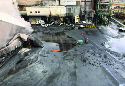
Garrett Neese/Daily Mining Gazette Stamp sands are seen on the shore in Gay near the former Mohawk Mine in a 2022 photo. A Buffalo Reef Task Force plan calls for the contruction of a jetty to block further stamp sand migration from reaching the reef, and for the sands to be excavated and moved to a site inland near Mohawk.
HOUGHTON — One of the administrators working on the efforts to protect Buffalo Reef from encroaching stamp sands provided an overview and status update during Wednesday’s Wake Up Keweenaw presentation.
Bill Mattes, Great Lakes section leader for the Great Lakes Indian Fish and Wildlife Commission, spoke about the ongoing project at the 2,200-acre reef, located in Grand Traverse Bay, downstream from the Gay Stamp Sands.
Nearly 23 million cubic yards of the mining waste was originally deposited in Gay near the Mohawk Mine. Over the years, about 10,000 to 20,000 cubic yards of the sands have been reused to provide traction on winter roads. Far more of it — more than 90% — has washed offshore, where currents have deposited it on the reef.
A task force of federal, tribal and state agencies formed in 2017 were charged with developing a long-term management plan to protect the reef. In January, the task force selected a multi-phase plan which includes blocking the stamp sands and hauling them to a site upland where they will be blocked from the water. The public comment period on the proposal ended earlier this year.
Buffalo Reef provides critical spawning grounds for lake trout and whitefish. The stamp sand fills in the spaces between the rocks and the reef.
“When the fish come in, they lay their eggs on top of the rocks, the eggs go down and the air, wind and waves causes oxygen to get in there, and they hatch out,” Mattes said. “The stamp sands fill in there, so they don’t have a place to go.”
Additionally, the copper in the stamp sands is toxic to them, Mattes said.
The same happens at the native sand beach south of the reef. The beach is also a feeding ground for juvenile whitefish, which eat benthic invertebrates. Those too are affected by the copper.
“The sands are toxic to them, they have copper in them,” Mattes said. “So we don’t find the benthic invertebrates on the sand. Therefore, we don’t find the juvenile fish.”
Without action, the reef would be covered; models predicted by 2025, 60% of the reef will be unsuitable for spawning. Sands would overtake Grand Traverse Bay, filling the harbor with sands and constricting or closing off the river outlet, Mattes said. That would lead to increased flooding risk.
The stamp sands also have negative consequences for property owners downstream, either from washing up on their beaches, or by covering up native sand that’s better able to dissipate wave energy.
Instead, it “heads up the beach a lot further harder and can cause flooding and damage to the landowners,” Mattes said.
The first phase of the task force’s plan would include a new round of maintenance dredging and the construction of a jetty, which will jut into the bay into the underwater path of the stamp sands. As designed by the Army Corps of Engineers, it should be able to prevent the stamp sands from encroaching for 50 years. Ideally, “before they’d come around, they’d be gone,” Mattes said.
Subsequent phases will see stamp sands removed from the south shoreline, middle shoreline, then the north shoreline and a dune just offshore. That would happen between 2033 and 2044, according to a 25-plus year timeline shown by Mattes.
The stamp sands will be transported to an upland site. One has been identified near Mohawk, but the land has not been purchased, Mattes said.
The EPA would monitor the sites and have wellheads to make sure the stamp sands aren’t contaminating groundwater, Mattes said.
Before any of those phases can happen, they need to secure funding for the jetty. Projects so far have been funding through the Great Lakes Restoration Initiative, along with the EPA, Kewenaw Bay Indian Community, and U.S. Army Corps of Engineers.
They also need to find an entity that would own the entity and maintain it. The federal government isn’t eligible, but a state, federal or tribal partner could do it, Mattes said.
High costs are one roadblock. Real estate acquisition — and road easements to the upland site — are another.
“Some of the lands are owned by railroads that are no longer in existence, so it’s been hard to track down ownership,” Mattes said.
Michigan Technological University is also looking at stamp sands on the Lake Superior shoreline near the Freda area, Mattes said. There’s more shoreline and higher-energy waves, ensuring the stamp sands are more dispersed, he said.