Examining the Otter Lake Dam — part one
The purpose of this white paper, published in two parts, is to provide a detailed history, background data, and options for the future of the above captioned subjects. This should allow the interested parties to make an informed, intelligent decision regarding these currently sensitive issues.
Introduction/History
An investigation of the history of the area will let us look at what was before man settled the area. The Michigan Territory became a recognized part of the Northwest Territory in 1787. Michigan’s statehood became official on January 26, 1837, when it had 60,000 documented residents.
After Michigan was recognized as a territory, the government, under the rules of the Land Ordinance of 1785, which was the Public Land Survey System, surveyed the land. The government did this so they could sell or give land away.
The Michigan Baseline and Meridian were laid out commencing in 1815, which allowed survey crews to divide Michigan into 6-square mile townships east and west of the meridian and north and south of the baseline. Once this was completed other survey crews subdivided each township into 36 one mile square sections. The Michigan survey was completed in the 1850’s, with the UP surveys being done from 1845 to 1851. The Federal Government began patenting (deeding lands) in the early 1830’s and settlement of Michigan commenced.
The township lines, in which the Otter Lake/River/Sturgeon River complex lies (Township 52 North and Range 34 West), were surveyed/established in June of 1845. The township was then subdivided into 36 one-square mile sections from Sept. 17 to 29, 1849. A hand drawn map (1849 vintage) from that survey of the northeast part of the township clearly shows the Sturgeon River, at that time, did not empty into Otter Lake, but did come within a couple of chains (one chain equals 66 feet) of the lake. The map also shows a considerable delta at the mouth of the Otter River. This map and field notes are available in the Houghton County Register of Deeds Office.
Logging operations in the Otter and Sturgeon River watersheds commenced in 1872 by the Sturgeon River Lumber Company (SRLC). This company removed much of the prime timber in the area, being red and white pine, from 1872-1900. The Worchester Lumber Company succeeded the SRLC and harvested hardwoods for the growing furniture industry in Grand Rapids. They also cut the cedar, spruce, and tamarack until 1930, when they went out of business.
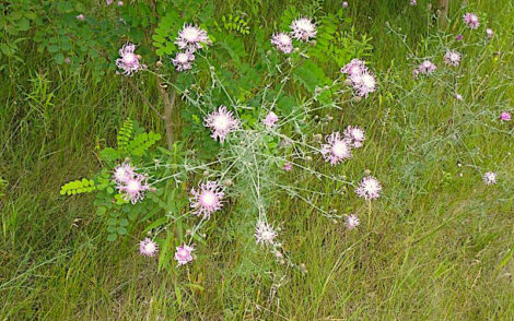
One of these companies built a levee on the Sturgeon River to keep it out of Otter Lake to ensure floated logs continued down river to the mills. This was necessary as once the area was logged and mostly denuded, water ran off quicker and carried a heavy sediment load. This levee was breached around 1913 and allowed all of the Sturgeon River to flow into Otter Lake. This allowed the deepening of the Otter Lake Outlet and subsequent seasonal, significant lowering of Otter Lake levels some 3-5 feet. This also resulted in the formation of a significant delta, which grew to 27 acres by 1938 and 54 acres by 1954. Many believe this was one of the best fishing spots in Otter Lake.
In 1952 talks began about what actions should be taken to resolve the extensive spring flooding, silt deposition, and lake levels. In February of 1973 the Houghton County Circuit Court established a legal lake level of 611.5 feet. This action was done without the consent of the riparians on Otter Lake, which, by law, requires a two-thirds majority to complete this action. This led to the completion of the Otter Lake Dam and Diversion project in the summer of 1975, at a cost of $372,548.00.
Physical Description
Otter Lake is located in east-central Houghton County and is 890 acres in area. It lies at an elevation of 611.5 feet, approximately only 10 feet above Portage Lake and Lake Superior levels, making the area downstream very susceptible to flooding. The maximum depth is 29 feet and averages between 15-20 feet deep. Twenty percent or 178 acres is less than 15 feet in depth. It has one named inlet, the Otter River, which enters at the extreme south end. Otter Lake also has 15 groundwater springs/seeps along its east and west shores. The water is tannic acid stained, so light penetration is limited to eight feet. The pH, alkalinity, and oxygen levels are adequate for aquatic life, although there is limited oxygen in the bottom 10 feet.
Continued next Friday …
Go Fish!