Latest updates from the Buffalo Reef Task Force
Here are the latest news updates from the Buffalo Reef Task Force on developments to save the natural underwater reef in Lake Superior’s Grand Traverse Bay, off the eastern side of the Keweenaw Peninsula.
Over the past roughly 100 years, historic copper mine tailings from the Wolverine and Mohawk mines – called stamp sands – were deposited at a milling site in the community of Gay, along Lake Superior.
Since that time, the stamp sands have been moved by winds and waves south down the shoreline roughly 5 miles, covering natural sand beach areas and threatening to bury spawning habitat and recruitment areas important to Lake Superior whitefish and lake trout associated with Buffalo Reef.
To help combat the threat posed to the reef and the harbor by the migrating stamp sands, various dredging efforts have taken place over the past few years, including removal of a 25-foot-high bank from the Lake Superior shoreline in 2019.
Harbor dredging efforts have worked to keep the waterway open for fishing, boating and other recreation.
In late 2020, the Keweenaw Bay Indian Community funded a project to pull stamp sands away from the breakwater and Grand Traverse Harbor.
Beginning this month, through state of Michigan funding, the stamp sand will be trucked 4 miles north of the harbor and placed in a temporary disposal area that has been constructed by the U.S. Army Corps of Engineers. This area is located on an existing stamp sand deposit, away from the immediate reach of Lake Superior.
The task force continues to look for beneficial uses of the stamp sands, as some type of product, but the remoteness of the stamp sand deposit and vastness of the area covered by the tailings provide challenges.
The work to move stamp sands from the breakwater and harbor during wintertime is expected to continue for the foreseeable future as the stamp sands continue to move south down the shoreline into the harbor.
Recent dredging efforts have helped keep the harbor open and protect juvenile whitefish habitat south of the harbor over the past year. Previous dredging proved successful only temporarily, especially with several intense storms off Lake Superior.
The state of Michigan has applied for a sitewide permit, recently noticed to the public, to remove all stamp sands. The purpose of this permit is to allow the state to take advantage of various opportunities, including potential beneficial use of the sands or to remove sand that presents a short-term threat to Buffalo Reef.
Having the permit in hand will make pursuing these opportunities easier should they arise. The permit is not an indication of planned work.
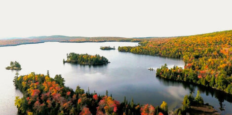
Tagged lake trout and lake whitefish returned to Buffalo Reef to spawn last fall. Acoustical monitoring data is being processed to learn which areas of the 2,200-acre reef are being used for spawning.
Initial telemetry data show that lake trout are spawning on the offshore, deeper portions of the reef away from the main pile of migrating stamp sands. However, researchers still urge caution in interpreting any cause and effect as it is unknown how much stamp sand has been transported to the outer portions of the reef.
Meanwhile, the Buffalo Reef Task Force continues to evaluate options to permanently protect Buffalo Reef and associated habitats. Top alternatives include building a stone retaining wall around the original stamp sand pile and the trucking placement site near Gay, placing all future dredge spoils there, or placing all the dredged stamp sand in a landfill north of the Lake Linden-Gay Road.
The evaluation process is expected to result in a long-term solution decision in 2022.
Front Page
Finno-what? Hancock: The first Finno-Ugric capital across the ocean
There’s been much talk about “Finno-Ugric” this past year in the Copper Country. The first part might ring a ...
Heartlands Board Readiness Subcommittee to hold informational meetings
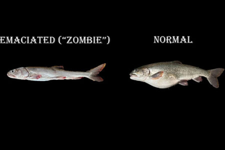
Researchers head to Superior Maximus to investigate ‘zombie’ fish
All good things come to an end
Time for a decision